Signal Knob, Strasburg, Virginia

Twice I have tried to climb Signal Knob in the Massanutten Mountains which are in Virginia.  Twice I failed, mainly due to the people with whom I hiked.   The first was a friend who was too fat to make it to the top; the second was with a boyfriend who was never able to get out of bed before noon so we didn’t have enough time.   This time I set out by myself to increase the odds of getting to the top.    

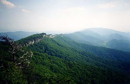
Signal Knob is a peak that is written up in every single hiking book in the Mid-Atlantic region because of its proximity to Baltimore and DC, a 2 hour drive.  It rises about 1600 feet, with easy switchbacks and gentle elevation.  It also boasts a large, easy to get to, parking lot.  For this reason, expect a crowd.

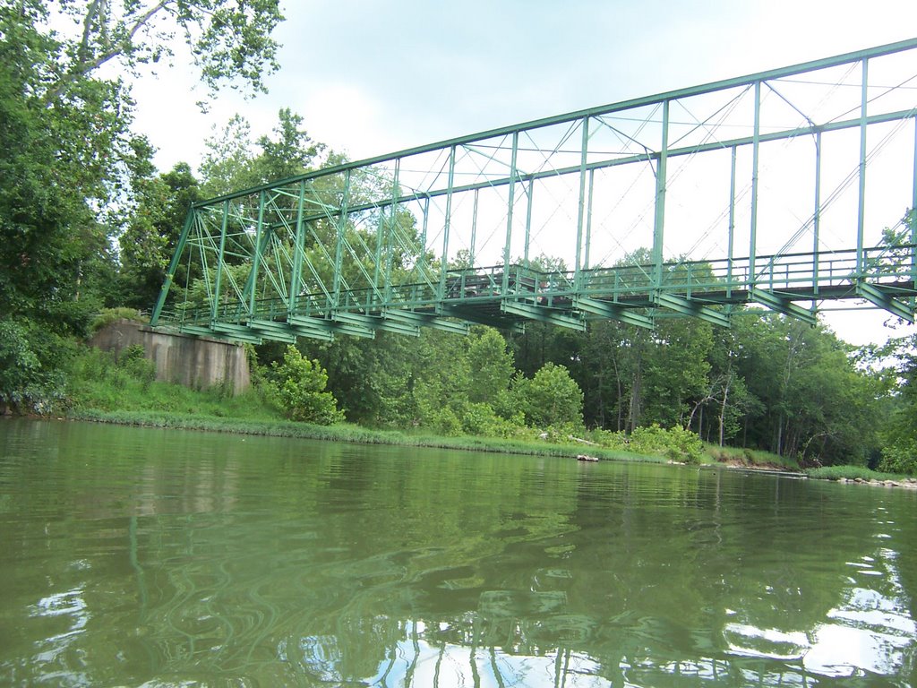
I wanted to explore Strasburg, VA which seems to be a small town which still has some industry but also has a downtown area.  The town seems lost between being a forlorn place that used to cater to the industry and farmers, and a new booming bedroom community.  I slept peacefully Friday night in the vacant lot behind the Valley Milk Products Dairy, which claims to be the only butter manufacturer in VA.  I think I have seen their products in the stores, I’d like to taste that butter, it sounds delicious.  I woke early and cooked my breakfast in the Strasburg Town Park which is located directly beneath Signal Knob.

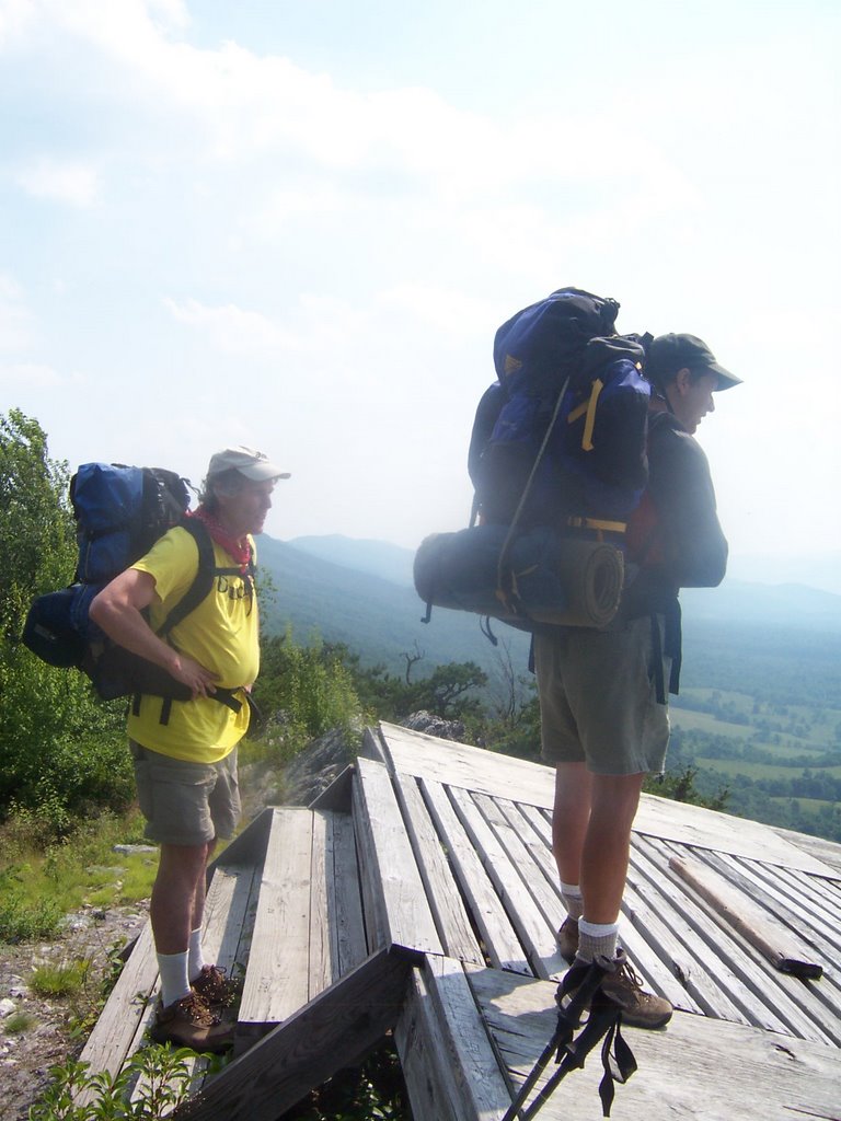
I arrived at the trailhead and noticed the air was hot and miserable.  I was sure it was going to be in the 90s, so I took along 3 liters of water.  I immediately started to sweat profusely and since I didn’t have far to go I took more than a few breaks.  I leaned up against a rock after about a mile and took off my pack.  A group of 4 young 20-somethings came barreling past me giving me the what-the-heck-is-this-dowdy-middleaged-woman-doing-alone-with-a-pack look and whizzed by me wearing cotton tank tops and cotton shorts.   The one carrying the purse mentioned she had already drunk most of her water.  They probably couldn’t figure out my choice of long pants on this sweltering day.  They were about to find out.

After they moved 20 feet up the trail I heard a huge commotion from them, the ladies were sending out little yelps.  I moved ahead to see what the problem was and they pointed out this rattle snake sunning himself on the trail.  
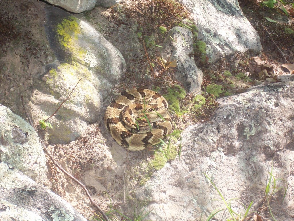
I thought he was very cute and took out my camera to snap a pic.  I’m not a snake expert so I took their word it was a rattler.  If anyone of my fine readers chooses to tell me otherwise I would be most appreciative.  I mentioned to the group that I had a snake-bite kit with me so if they got bit I was prepared.

Then I figured that the snake was 4 ft. long so I walked a six foot semicircle around the snake.  I had my poles with me so if he lunged I could deflect him.  The snake gave me a bored look and I went on my way, leaving the 4 screaming like little piglets behind me on the trail.  

The Massanutten Trail in this area is covered with scree which is another word for loose stone, although the scree seemed much looser in previous years.  This trail has seen a lot of use and much of the loose stone is now embedded in the mountain by trail shoes.  Here is a pic of the trail, don’t expect to move fast on this stuff.  

I decided to set camp up at Meneka Peak, the highest point in the area and then continue on to see Signal Knob.  
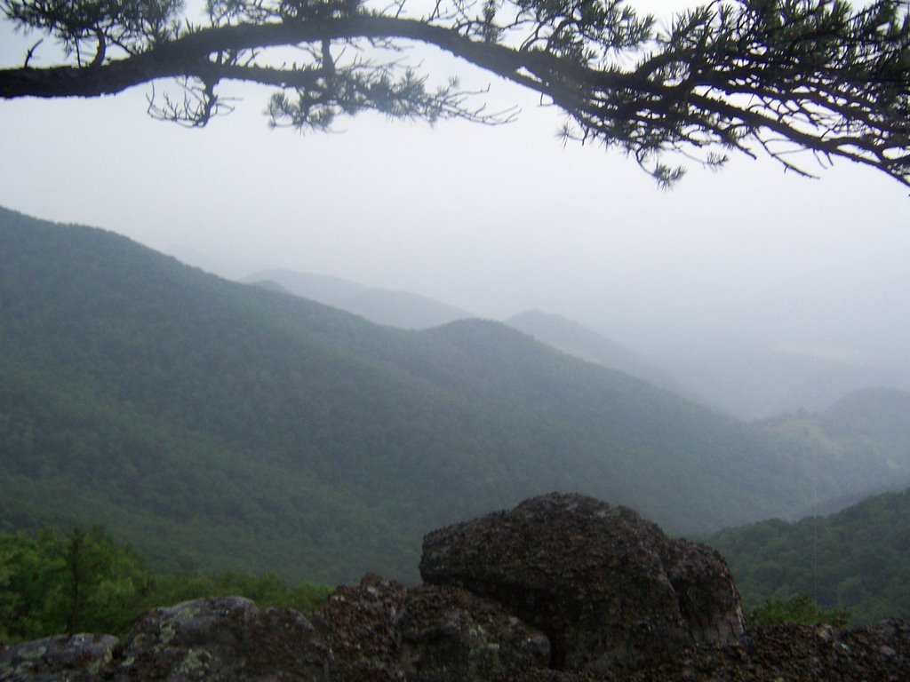
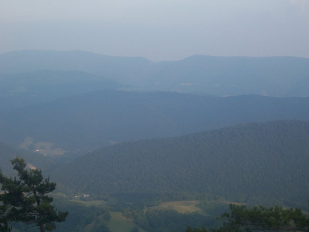
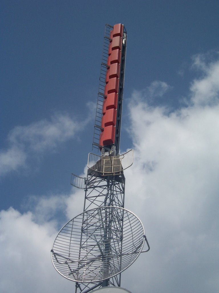
The Signal Knob tower was some very grand radio device which came with a large station house that had big noisy fans.  The fans were the only thing that provided a breeze on this weekend.  
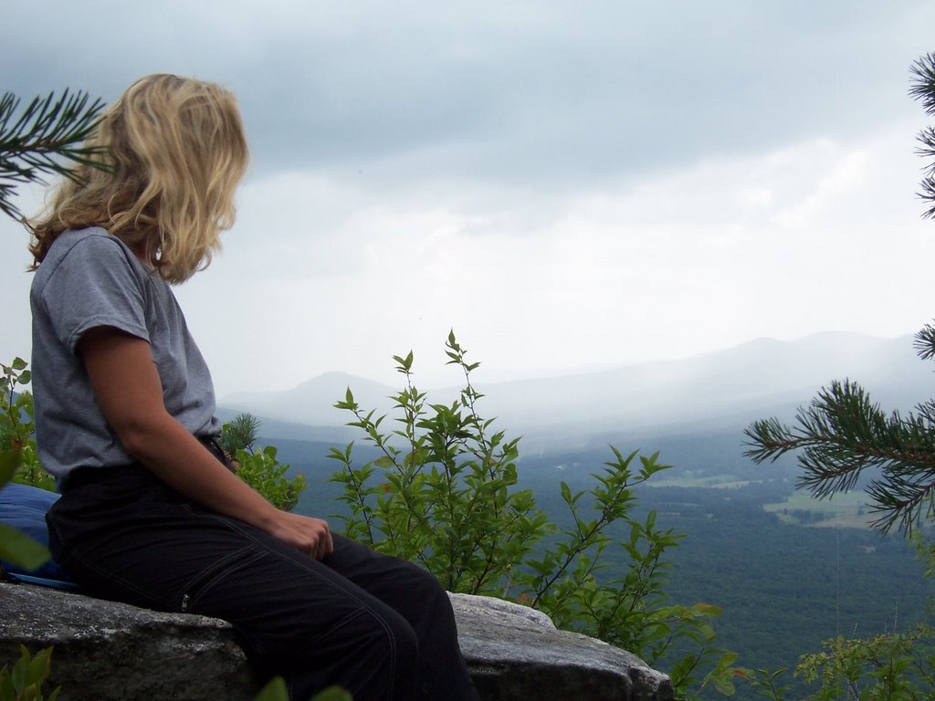
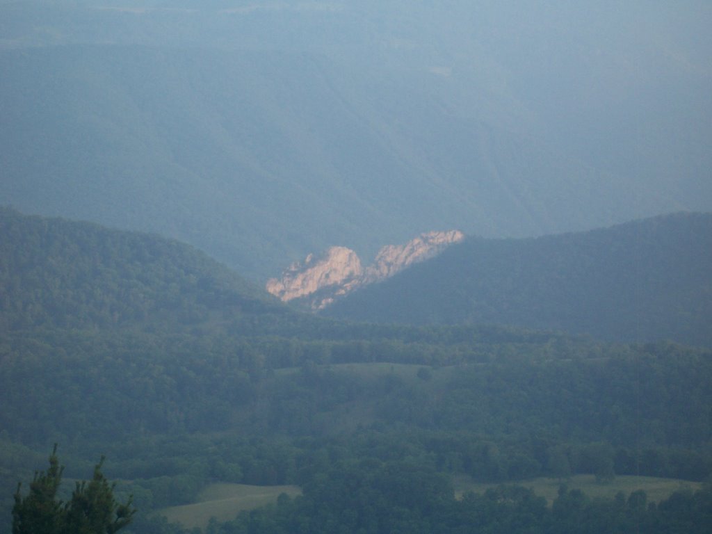
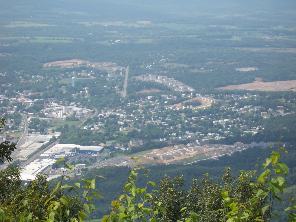
The city of Strasburg, its warehouses, rail line, housing developments and Interstate 81 proved to be not so picturesque from the overlook.  I returned to my campsite covered with a gooey sweat, took off all my clothes and retreated to my tent to read magazines.

A few months ago someone sent me an email about the bear that covers the Signal Knob territory.  The bear attacked a dog, the dog’s owner had to extricate his dog from the bear and then the bear had the nerve to chase both of them down the trail.  The local bear has no fear of people.  This made me more than a little nervous because there weren’t any other backpackers; I was going to be the only camper on the mountain.  I put every single food item and my toothpaste in my bear-bag, and then spent 20 minutes choosing a very high branch and getting the bear-line set as far as it could go.  

I didn’t put the cover on my tent and went to sleep praying for a breeze.  There was no breeze forthcoming.  I fell asleep and was awoken in the night by a noise.  I managed to get back to sleep and in the morning retrieved my bag.  My bag was still there but underneath the bag was a pile of fresh bear turds.  Mr. Fuzzy left his calling card.

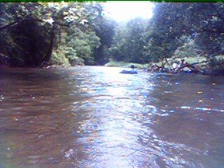
After waking, I dismantled the tent and descended on the Tuscarora Trail which had less scree than the Massanutten.  I was going to go tubing but it was just too darned hot.


Halfmoon Mountain Revisited, Tubing on the Cacapon, West Virginia


The weather called for rain and thunderstorms for this weekend, I felt confident anyway because I finally broke down and spent the $4 for a rain poncho. I decided to craft another backpacking loop out of Halfmoon mountain in the George Washington National Forest.I had a bunch of reading to do so I put all my gear and magazines in the minivan and left late Friday. Somehow I managed to find the trailhead off of Trout Run Road (P2)in pitch dark and spent a very pleasant night in the van. It's very dark and quiet in that spot. The next morning I headed out confidently on the trail with the map in my pack. The map would have helped a little more had I bothered to look at it because I went the wrong way, I ended up hiking up on what I had planned to be my return segment. Flexibility is the key to life.

The Bucktail trail doubles as some sort of forest Road, I don't much care for hiking on roads, I don't like the surface. But my attitude completely changed when I hit a trail called German Wilson, this beauty rises 1200 feet in 1 miles, all on a miserable slippery rocky surface....pure heaven. I became enchanted with all the pretty mushrooms and one lizard which I saw on my way up. I took a bunch of pictures, I'll call this my mushroom study.


Even though I had dilly dallied with the mushroom fascination, I managed to summit on Half Moon in 4 hours. I spent the afternoon catching up on all my reading.

Since I hadn't met any other hikers on the way up, I figured I was safe to camp at the very summit placing my tent at the top, directly on the trail. Fortunately, nobody came by to complain and I had a beautiful view. I made a fire and burnt all my reading material. It rained for some of the afternoon but the poncho kept my dry.

Sunday, it was cool for once when I woke up. I hiked down part of the Halfmoon Trail which was very gentle, I would say it would be ideal for beginning hikers, I then returned to the trailhead via the Bucktail Cutoff Trail, also very nice. This area seems to be very popular for horseback riding, as I saw a bunch of horses and riders at the trailhead. It only took me 2 hours to get down so I had most of Sunday left to do something else. I decided to go tubing. Tubing on the Cacapon near Yellow Springs

View Tubing on the Cacapon in a larger map
I've been a little fascinated with the Cacapon River so I decided to find a place to tube on it. I followed route 259 northwards and decided to tube the stretch between Capon Lake and Yellow Springs, about 2 miles.
The first mile was a great deal of fun but the last stretch was a little slow. I used my bike which I had locked up at Yellow Springs to get back to my car.

Update 9/13/09 Someone asked me about the parking area for the Halfmoon Hike. I created this map with associated coordinates for the parking areas. I used parking area #1 for this hike. Slap those coordinates into your GPS and you are so there.

Tubing on the Gunpowder, Monkton to Glencoe, Maryland


View Tubing Monkton to Glencoe in a larger map

Directions to the Monkton Parking lot: Take exit 27 on 1-83. Head East on Route 137 Mount Carmel Road. Travel .6 miles. Take a right on York Road Route 145 going south. Travel one block. Take a left on Monkton Road, Route 137 heading east. Travel another 3 miles. At the bottom of the long hill you will see the river, the train station and the parking lot, as well as the tube rental store.

This year I decided to make a tubing trek from Monkton to Glencoe a Mountain Club of Maryland trip so I could get some more detail and pics for all of you who have interest. I didn't do much to advertise this event and only one kind soul showed up to go with me. After making these big plans to get better pics, I ended up leaving my dry bag and good camera at home. So these fuzzy low-resolution pictures taken with my PDA will have to suffice. My apologies!

I had never tubed from Monkton to Glencoe although I have tubed several other stretches of the river. Luckily we had much rain recently and somebody decided to open up the gate up at Pretty Boy so the Gunpowder was flowing fairly fast. The river was still pretty shallow though so we didn't need to worry about drowning. My cohort, Ellen, rented a tube at Monkton Bike Rental, it was a truck inner tube with a really nice cover on it as well as a mesh bottom. Ellen is a MCOMD member who recently moved here from Tucson.

The Gunpowder water was cold as usual. A bird followed us down river and Ellen managed to get herself bit not once, but twice in the same area of her elbow by bees. Her arm puffed up a bit but we were having too much fun to be concerned. I hope she doesn't end up in the hospital tonight.
The river twisted and turned, it took us about 3 hours to get down to Glencoe. We returned to Monkton via the NCR trail.
UPDATE June 2008 For another post about tubing on the Gunpowder River at Big Falls, north of Monkton click on this link I've got directions, map and video for you.

UPDATE July 13, 2011 I went down this Monkton to Glencoe route again yesterday. Air temp was 95 degrees and sunny, and by the time I got out of the water at the second railroad bridge after 3 miles, I was blue from the cold water. The river was absolutely spectacular, I can't say enough good things about this stretch. About every 0.2 miles I met a new big blue heron. The riparian area is alive with kingfishers too. I saw one deer. I don't know who is doing what to clean this place up but there seems to be far less sunken tires and debris in the river and I could see the improvement. The tube rental place is offering a "free" shuttle included with the price of the tube rental to take the tubers to a point north of Monkton, so all the tubers seem to be on that stretch of the Gunpowder now. If you want peace and quiet yet a good tube run then Monkton to Glencoe is for you.

North Fork Mountrain Trail, End to End, West Virginia

Photobucket


Last year when I was visiting Seneca Rocks I had the opportunity to stumble upon the beautiful North Fork Mountain.  I made a vow on July 4th, 2005 that I would spend Independence Day weekend in 2006 thru-hiking the short 23.8 mile North Fork Mountain trail in West Virginia.  I started researching the hike in the winter and noted that there are no water sources on this trail, however there was a mountainous fire road that led to a place I could use for a water drop at the 10-mile mark.

I knew that I would be biting off more than I could chew if I went alone because a vehicle drop would be required so I put notice of my intentions on the Outdoors Club board and hoped for the best.  2 other backpackers, both of which I knew, decided to take their chances with me as group leader and make the trek.

On Saturday, we left Keith’s car at the endpoint and proceeded on the fire road (FR79) for the water drop with the minivan.  My poor car made it to the peak on low gear and I smoked my brakes on the way down.  A rock in the road put a huge scrape in my oil pan too.  But we managed to leave several gallons of water at the radio towers.  The trailhead at the south end is off of Route 33 near Judy Gap, one needs to go to the electrical substation at the top of the ridge and the trail begins at the private entrance behind it.

The views on both sides, east and west,
of the trail are breathtaking.  You get a great view of Dolly Sods, Seneca Rocks and even Spruce Knob if it is clear,
just a great feel for the entire Monongahela Mountain Range to the west.  However, since you are on a ridgeline, expect there to be wind.  Since it was warm the wind cooled us down, but at night the noise from the gusts were a bit irritating.  If you attempt this trail in winter I would suspect you would need really warm clothing.

We camped near a great view of Seneca Rock the first night, and then a wonderful view of
Yellow Rocks the next.  Howard had been purchasing new gear for weeks before this hike, and I was glad to see that he had amassed the necessary gear, and a few extra pieces to make the hike a success.   We passed some sort of multi-state science youth group along the way, kids had came from every corner of the country including Mississippi (who thought the area was very mountainous) and Alaska (who thought the area was a little flat). They seemed better behaved than I would have been at that age.

We were glad to see our water stash at the radio tower, filled our bottles and bladder, then we washed up as best we could with the remaining water.  It got hot and buggy the second day. We managed to walk 11 miles on Sunday but Howard finally staged a mutiny and refused to go any further so we set camp.   When we woke up Monday morning we used up the rest of our water for breakfast, then it began to rain.  The rain cooled us down, and gave us an opportunity to rehydrate by licking the rainwater off the leaves.  Keith speculated whether we were going to get sick from doing so.  So far we all seem okay and none the less worse for wear.

We walked the last 5 miles after it cleared up and without incident,
Keith took a nap at the overlook.  We actually met someone from West Virginia hiking along the way which was the first time ever I had met a West Virginian on a hiking trail, maybe this state is ready to get healthy after all.

We had a pretty good time.

North Fork Mountain Trail profile