Tubing on the Potomac, Harpers Ferry, West Virginia


View Tubing on the Potomac in a larger map
I promised myself no hiking this weekend, so I headed out to do more tubing.  I didn’t want a long ride so I headed to Charles Town, WV.  

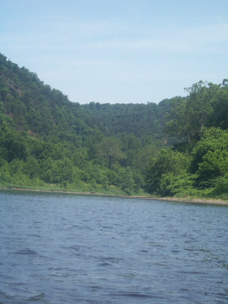
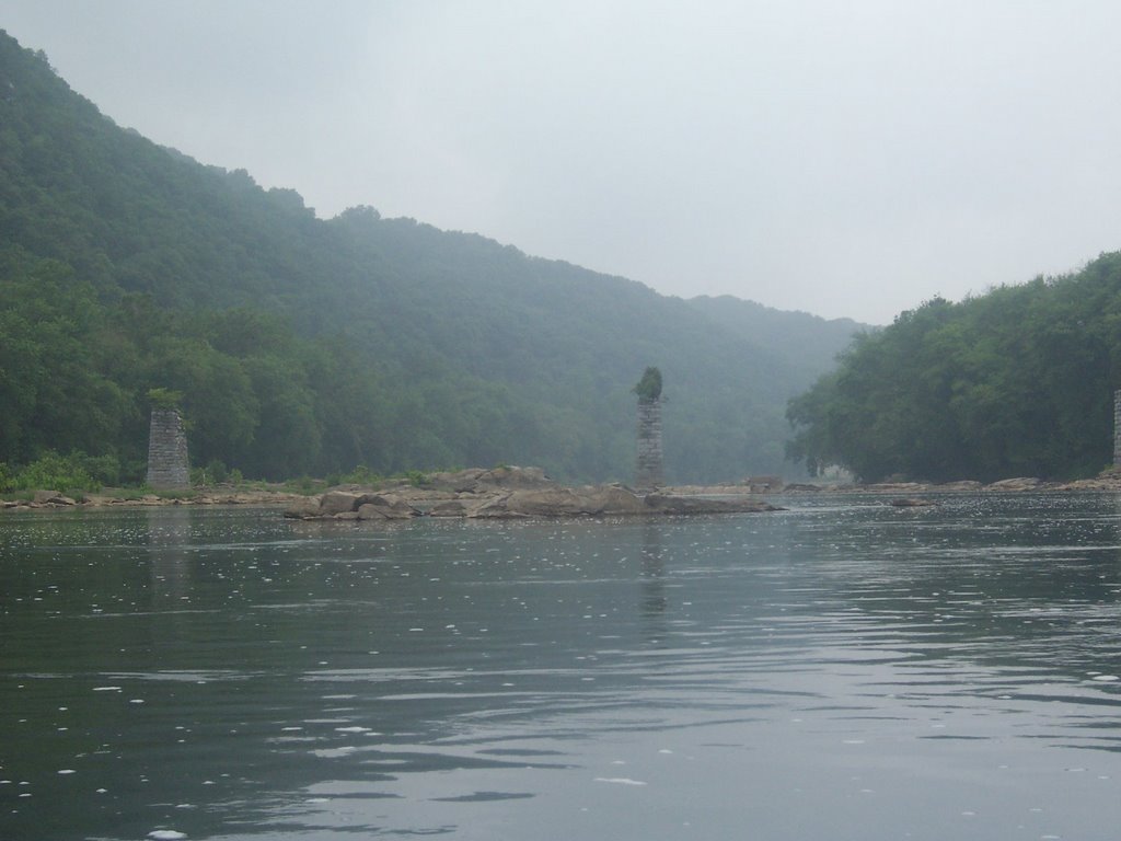
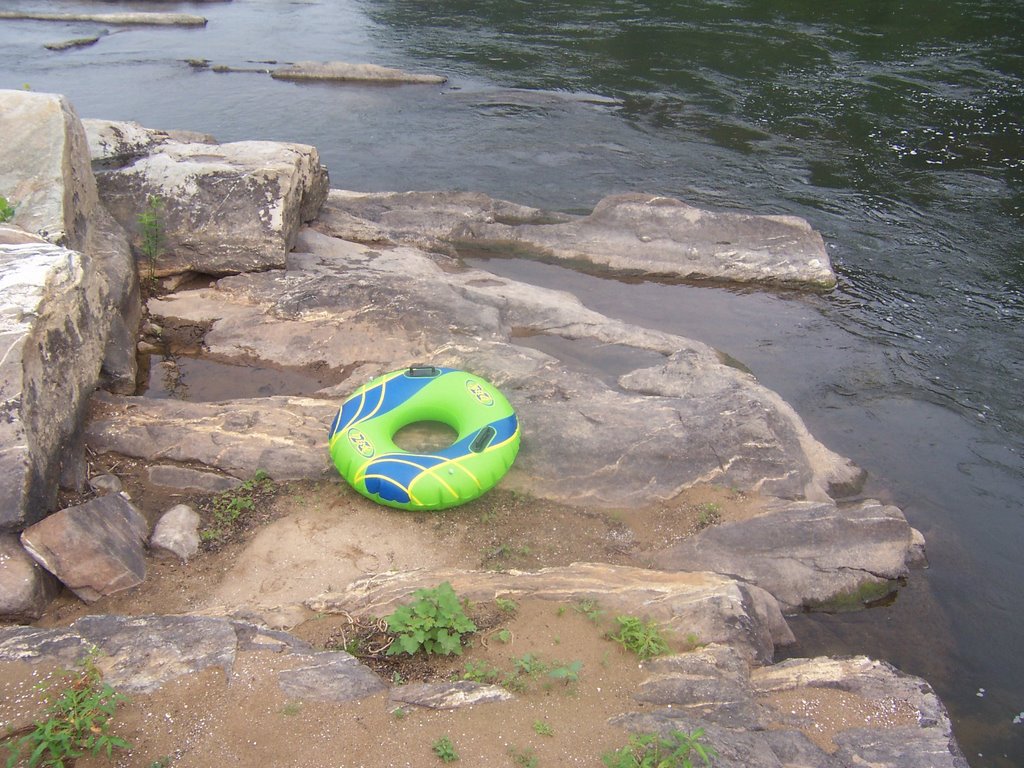
I spent the night on a quiet street and then headed to Harpers Ferry the next morning.  It was really overcast and after mulling it over I decided to take my chances with an early tube run.  I locked my bike and pack at the C&O towpath and AT intersection at Weverton and then drove ¼ mile north of Harpers Ferry for a put-in. One word about this area, PFDs are required.  I was the only one on the river and was able to get up close and personal with some 
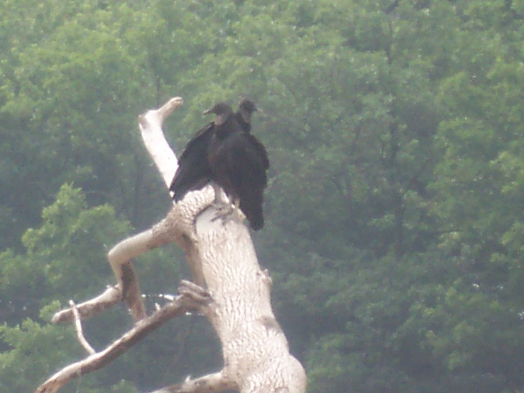
turkey vultures that were hanging out on the rocks below HP.

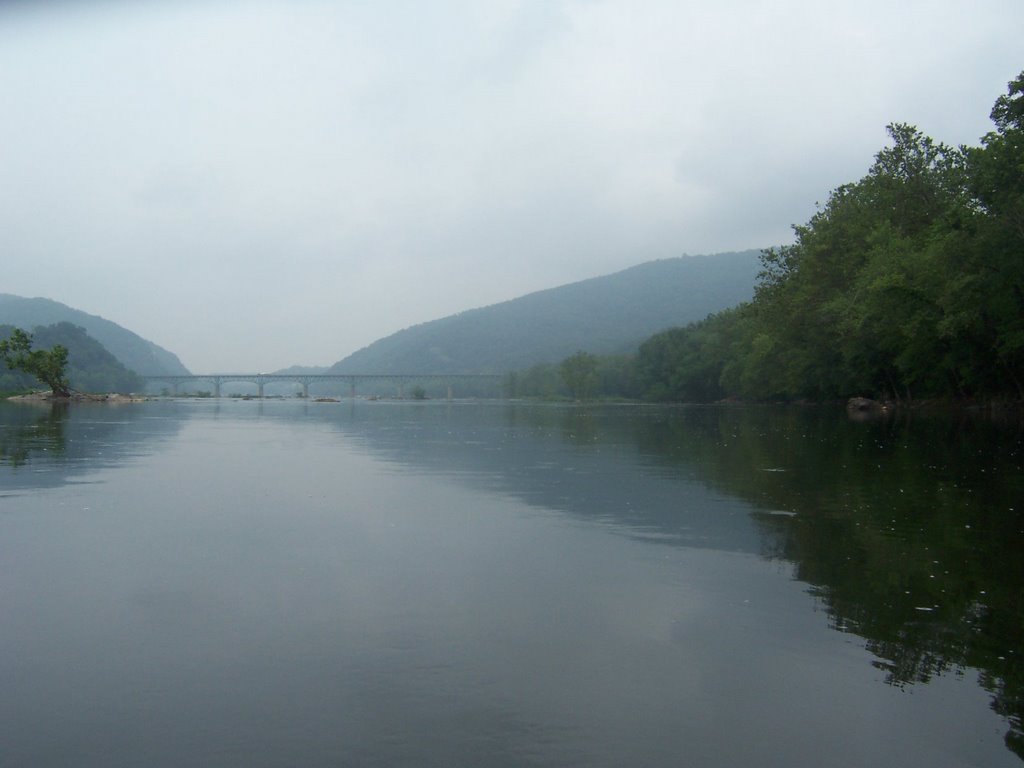
The best rapids on the river are about  1/3 of a mile northwest of the Sandy Hook Bridge.  The river moves pretty well but not too fast in these parts.  Good for tubing.  
While near the end of my run some people came by in kayaks, they were taking a beginning white water kayak class.  The instructor was a bit of an pest and tried to start a conversation with me, I wasn’t having any because he was annoying.  
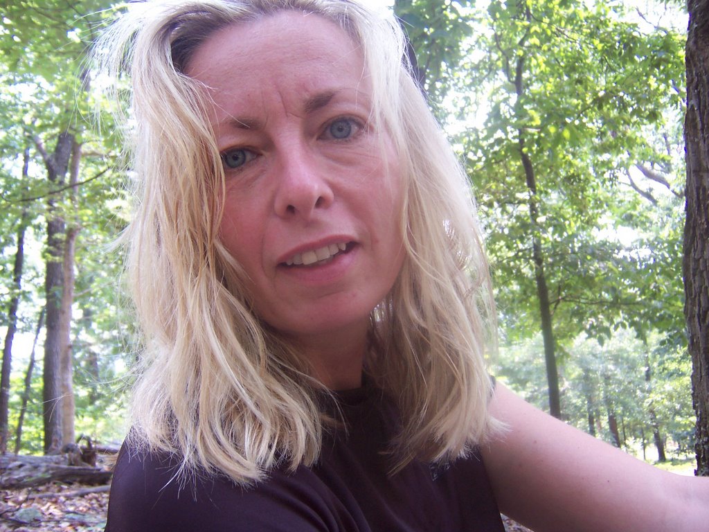
The instructor told his pupils about all the safety equipment that was absolutely positively necessary when on the river like helmets and paddles and other useless crap.  One student asked the instructor about me, who had none of the above equipment, and the instructor boldly informed him, “The woman in the tube was most likely a tube guide.”   My already large ego was just expanded, now I am a tube guide!  Who knew?

Feeling pretty good after I returned to my car I drove back to Charles Town, jumped on somebody’s Internet connection to see if there was any live music playing.  Charles Town is a bit of a dud when it comes to night life and the only band I could find that wasn’t at a country club was at Charles Town Raceway and Slots.  I figured, “Why not?”

So off to the casino I went.  Mind you, I don’t drink, smoke or gamble and I had already eaten but I didn’t have anything better to do.   I ended up walking in the wrong door and couldn’t find the casino.  A security guard saw my confusion and asked what I was doing there.  I tried to look like I belonged there and said I was confused about how to get upstairs.  He said to me, “What are you, a horse trainer?”

I got demoted from tube guide to horse trainer in a span of three hours.  I realized that maybe I did look like a horse trainer, I was still wearing my Wal-Mart river clothes and a bird had defecated on my shoulder during my tube run, I hadn’t done such a good job of cleaning the mess off I guess.  

The slots casino was a happening place, think Las Vegas but with maybe 1/100th of the budget.  The bones of the structure were definitely a large warehouse gussied up with plenty of flashing lights and thousands of slots machines.  It was filled with people from the Mid Atlantic area.  Mind you, nobody at this place would ever be accused of styling and profiling.  This was a shorts and tee-shirt type of crowd.  I saw a couple of the horsie races. The jockeys looked like they all came from the same Latino country, they were cute, and I am wondering if somebody could clue me in to where they are from. The featured band, Quiet Fire Soul Show, was set up in the middle of rows of slot machines and people gathered around to here its soul and disco music.  Pretty soon we were all dancing happily in the rows of slot machines.  A word of advice, don’t order the Brownie Sunday at the casino food court.  The brownie tastes like regurgitated cigarette butts.

I spent Saturday night in another quiet neighborhood in Charles Town.  I woke up and it was raining so I decided to drive home, not willing to find something to do in the rain.

Tubing on the Potomac, Sideling Hill, Maryland: Berkeley Springs, WV

It's getting hot out there folks.

The temperature in the Free State has climbed and the humidity is abundant, which means it is time for less hiking and more doing anything else but hiking. When one hikes, you sweat which attract these annoying little bugs that dance merrily around your head.


So I decided to wander over to the Potomac with my float tube. I didn't get going until Saturday morning. Once on the road I realized I forgot my camp stove. So I stopped off in Hagerstown at the Coleman store to buy a backpacking stove which I needed anyway. I got a great lightweight number for $20 that works amazingly well, thanks Coleman!

I started my tube run at Little Orleans/Fifteen Mile Creek. Since we have been lacking in rainfall the river was really slow. I only planned to go 4.2 miles so the slow flow wasn't much of a problem. I took a number of pics, saw a bunch of fisherman and did some swimming. I had to make a guesstimate of where to perform a take-out since there was nothing on the river to indicate where the northern tip of the Western Maryland Rail Trail at Pearre was. It turns out I was only about a quarter mile off, and I quickly found my bike and backpack which I had locked up at the parking lot. The deflated tube and PFD fit nicely into my backpack and I returned to the put-in along the C&O Canal towpath. An easy day.

I cooked my dinner in Hancock at the Widmeyer Memorial Park and then decided to head to Berkeley Springs in West Virginia. What normally comes to mind when I think of West Virginia is squalor or shambles, but Berkeley Springs is anything but. I don't think it hurts that Berkeley Springs is surrounded on three sides by Maryland, which seems to have a positive influence. There was not one sign for Family this or Family that. I felt welcome.

Berkeley Springs
has a number of art galleries, a bunch of small hotels and B&Bs, and a nice selection of restaurants. It is at the foothills of Cacapon Mountain. I noticed a sign near the 7-11 advertising live music at the Red Guitar Coffee Bar on Saturday night. Since it was Saturday I decided to head over to see what was going on. The duo that was playing was Little Maggie. I took one look at these aged hippie ladies and shuddered, I thought for sure this visit was going to be a big mistake. But the ladies proved my initial reaction was wrong. The harmonized and didn't sound too bad, in fact, they sounded pretty good.

Afterward, I parked my car in a large parking lot near 2 tractor trailers and fell asleep. I woke up and cooked my breakfast in Berkeley Springs State Park, in the downtown area. I couldn't help but notice all the warm springs outside and the spa on its premises so I asked a park ranger what went on in there. He recommended the massage and roman bath option so I decided to make a reservation for one after my hike. I might be cheap when it comes to food and lodging but start talking deep tissue massage and the credit cards start to fly.

I wanted to do a quick hike that would not interfere with my scheduled massage. So I headed toward the Maryland side of Sideling hill, back to the Pearre parking are of the WMRT. I looked very hard at the Marland Department of Natural Resources map of Sideling Hill. I want to let everyone know that this map and reality have nothing to do with one another. The trails on the map tend to mysteriously end, and they don't go where the map says they are going to go. I also notice some phantom roads on the map as well. C. Ronald Franks has his head up his ass on this one.


I headed back to Berkeley Springs for my massage. The Berkeley Springs Spa turned out to be in a building that looked sort of like a prewar mental hospital with glazed yellow tile. The building was solid as a rock so no upgrades or rennovations are necessary. But who can fault a state park that has a low-cost spa? Maryland can take a lesson from West Virginia in this regard.

I had purchased the roman bath/30 minute massage/shower package at the competitive price of $45. The roman bath was totally cool, it was like having your own little indoor heated pool. They say the Berkeley Springs waters are healing, but I couldn't tell, I'm in great physical shape so there was nothing to heal. My masseuse, Ruth, did a wonderful job removing the toxins from my body. Then I got to take a shower and wash my hair which was yucky from the sweaty hike and the river.

All in all, a much improved weekend over the last one. I will definitely be heading back to Berkeley Springs in the future!

Leading Ridge Trail, Shenandoah National Park, Luray, Virginia


They see me rollin
They hatin
Patrolling
they tryin to catch me ridin dirty
Tryin to catch me ridin dirty


The Shenandoah’s have never been my favorite mountain range.  Mind you, they are a perfectly good set of mountains, but I have real issues with that Skyline Drive at the top so I tend to bypass them and head towards the more secluded and laid-back West Virginia.  But rumors were spreading among my hiker friends about a trail that had 2000 feet of elevation change in 1.2 miles.  This had to be experienced.

I headed out toward Luray, VA on Friday, I had visited Luray back in November and was charmed so I decided to return to this little mountain town.  The economy has been kind to Luray and the place seems flush, they have built 2 massive parks for it residents, Lake Arrowhead Park and the Luray Recreational Area.  Luray touts itself as a town of family values.  You see signs proclaiming stores and businesses are for “families”, as in “Family Convenience Store”.  The Luray Wal-Mart Super center teaches children “family values", the public park is "family-friendly".   Needless to say, as a woman with no family and no values, Luray did me just fine.

I made copious use of all of Luray’s family resources.  I cooked all my meals at the 2 family parks, I used the family trash cans, I washed my dishes in the family lake,  I jumped on a local family’s internet connection to check my email and I slept in the parking lot of the family-oriented businesses.   Unfortunately for Luray, I put no money into the local economy, perhaps if the made this single woman feel more welcome I would have spread my money around a bit more.

Saturday morning I rose early and found the trail (more on that later).  I was able to complete the 2000 foot rise in an hour.  The Leading Ridge Trail starts at the base of Mary’s Rock near Thornton Gap in the mid Shenandoah’s; it is a wonderful unmaintained trail with few rocks.  I recommend it for hikers that like fast rises and are in good shape.  Once I got to the intersection of the AT I met a NoBo thruhiker from Dallas.  I mentioned that I thought he was passing through a bit late, he said he didn’t want to hike in the snow so he left in early April.  I hope he realizes that he is going to head straight into the black flies in Maine in September.  Snow is nothing compared to those vicious man-eating flies.  

Then I met some PATC trail manicurers.  I made the mistake of mentioning that I had hiked up the Leading Ridge Trail.  One of them demanded to know where I started on that trail.  You see, there is no public access at the base of the mountain for the Leading Ridge Trail, but that wasn’t going to stop me.  My guess is that years ago at the trails inception a land-owner didn’t mind hikers walking on his property to get into the park.  However, as property values have skyrocketed and land has changed hands, the most recent land-owners are adamant that no wayward hiker step his little toe on their precious property.  

But “No Trespassing” signs have never stopped Cham ever.  I explained to the PATC guy that I merely studied my PATC topo map, compared it to the topography of the area, made a guestimate of where the trail might be and bushwhacked my way in to the park on private property.   Mr. Trail overseer didn’t seem happy.   I am sure he had visions of putting a big chain-link fence to keep hikers like me from breaking the PATC rules.  Don’t worry folks, I own a bolt cutter.

The Appalachian Trail at the top of the Shenandoah’s is awful.  The PATC has over-maintained it.  The trail is without impediments, has been graded, has way too many signs and, worst of all, has little rule placards about where you can camp, removing your trash, leaving no trace, and various other little tidbits that are an insult to everyone.  The might as well pave it and provide electric golf carts for the hikers.    You spend more time reading the signage than enjoying the hike.  

I appreciated the view off of Mary’s Rock but the wind had picked up and I decided to cut my hike short.  
The mountain laurel is now in full bloom and is very plentiful at around the 2500 feet elevation.


Once I got down to the bottom I noticed the property owner was busy shooting cans in his yard.  Figuring the owner could easily shoot me as I trespassed (“Officer, I thought the hiker posed a threat to the safety of my family so I had no choice but to shoot her”. Never trust those gun-lovers.) I decided to bushwhack through another’s yard.

On Sunday I had plans to tube on the South Fork of the Shenandoah River but it was a little chilly so instead I took a ride on Skyline Drive since I still had the parks pass from the Grand Canyon trip.  The drive made me dizzy.  I would much rather hike to the top of a mountain than drive it.  Never again.


Pond Run Trail, White Rocks Trail, Sugar Knob, Tuscarora Trail, West Virginia

This week lent itself to backpacking because I already had a nice bag of food neatly packed in my refrigerator,(reference the entry from last week). However, after having a raucous week of spirited sales phone calls with customers, bosses, and worst of all...evil evil satanic channel managers I decided I didn't want to see or talk to anyone, which meant group hiking was out of the question.


I have hiked most of the popular trails around so I started looking around on the net for a place that wouldn't be populated, could give me some decent elevation changes and mileage, and not too long a drive from Charm City. I stumbled upon this hike from MidAtlantic hikes, a site set up by some guy who is active in the HoCo Sierra Club. The hike includes a segment on the Pond Run Trail which doubles as a segment of the Tuscarora Trail.

Some background: When the Appalachian Trail was set up back in the 1930's, the creators may not have secured the right-of-way of the trail through private lands. This became abundantly apparent later on when landowners started wondering why all sorts of backpackers were straggling through a white-dotted path on their land without their permission. Concerned about the security of the AT, various groups got together in the early 1960s and set up a bypass trail called The Tuscarora Trail.
This blue-blazed 252 mile trail stretches from VA into PA to the West and parallel of the AT, stradling the WV and VA line isn't as plundered as the AT, but is still traveled and thruhiked extensively. It took several years for the National Parks Service to secure all the land rights and easements to make everything copacetic on the AT. The last bit of the AT was secured in the late 1990s in, of all places, Maryland. Leave it to those pesky Marylanders to hold onto their property rights of a mere 40 miles of trail to the bitter bitter end. Everyone in this state wants to make sure they make every possible dime on even the teensiest weensiest piece of property.

Now back to this segment of the Tuscarora Trail: The Pond Run Trail ends at Pine Knob lookout which looks out at Half Moon Lookout, Half Moon Lookout faces Big Schloss Lookout, where I was backpacked 3 weeks ago. So everyone on all three lookouts can look out at each other. So I was near Wolf Gap and on Sugar Knob.

I met some wonderful thruhikers, a couple of older men attempting a 2 week thruhike of the entire Tuscarora Trail, which means they had to average 15 miles per day. They were only carrying small daypacks. I asked about the weight of their packs, and they told me 6 pounds. Talk about achieving new heights in the ultralight wars!

The men were using a tarp for a tent, a tarp for a sleeping bag, no stove, no extra clothing and a thin pad. Their pack weight was mainly food and they only planned to restock once during their hike. The 20 pounds that I was carrying on my back suddenly felt like 300. I wished them well and moved on. Then I came to my second thruhiker, a woman that looked like she had been on the trail a long while. She glared at me and I stepped aside to let her pass. She was quite odiforous. Mind you, I can see if you are doing long stretches in a desert you might get a little ripe, but we were hiking next to a relatively warm gurgling stream. You would think this lady might take the time to dip herself and her clothing in it every once in a while to get the stench off of her.

Anyhoo, I learned a whole bunch of stuff during my hike. I will list everything in order:

1. When one takes a ballpeen hammer to their printer because it doesn't behave, one cannot conveniently print paper hiking maps. One must go through the complex process of downloading maps, directions and other information to their PDA.

2. When one takes a PDA on a solo backpack, one is prone to playing hours of solitaire wearing down the precious battery charge precipitously.

3. National Geographics don't burn. The severe glossy chemical coating on the magazine renders it useless in starting a campfire, although the idea to bring the magazine along, read it and then use it as kindling was a great one in theory. Next time, bring the City Paper.

4. When one forgets a line for the bear bag, a 20 ft. satellite radio antenna works just as well. The little magnet on the end is perfect for tossing into a tree.

5. When one gets to the intersection of the Mail Trail and Racer Camp Hollow Trail, don't go left because that isn't the right way to go. You could go, let's say 1 mile down the road before you realize this and have to turn back...extra hiking mileage: 2 miles.

6. When one returns the intersection of the Mail Trail and Racer Camp Hollow Trail, don't go right because that isn't the right way to go either. You could go, let's say 1.5 miles down the road before you realize this and have to turn back...exra hiking mileage: 3 miles.

7. At the intersection of the Mail Trail and Racer Camp Hollow Trail, the correct way is completely hidden in the woods. There is no markings whatsoever and in a month of high foliage like June you won't be able to see the continuation of the Mail Trail.

I had expected to hike a simple 12 miles with 1600 ft. of elevation change, but it ended up being closer to 17 miles.